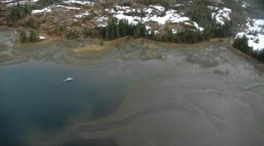
ShoreZone Mapping involves shooting aerial video of shorelines during the lowest tides of the year. Biologists and geologists aboard the aircraft provide commentary on the video sound tracks during the overflight. Their information is used to created detailed maps and databases of the shorelines that were videotaped; in addition, the video itself becomes part of the ShoreZone information bank.
In 2014, the council upgraded the Prince William Sound ShoreZone imagery into digital format. The original ShoreZone imagery, which the Council helped fund, was shot on video tape. The new digitized videos are easier to edit and can be streamed on the Shorezone website. This imagery is useful in spill response planning and operations, coastal management, research, or other science.
The Council’s primary goal in ShoreZone Mapping is to have this detailed information available for use in oil spill response planning (including the preparation of Geographic Response Strategies) and in actual responses. However, the information has other uses as well, including research unrelated to oil spills, and education.
The imagery and corresponding maps are available at NOAA Fisheries website: Alaska ShoreZone Coastal Mapping and Imagery