Accurate and timely weather data and reports are essential to supporting safe navigation and preventing accidents. Accurate data supports the Council’s mission by providing the organization with the best scientific knowledge on weather in the region to help make informed decisions on spill prevention and response and to support safe navigation of tankers.
Weather tracking resources
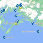
This Google map* contains links to these and other weather resources in our area, some sponsored by the Council, others by our partners at Alaska Ocean Observing System and the Prince William Sound Science Center. The map also includes links to National Oceanic and Atmospheric Administration’s weather buoys in our area. Data such as air temperature, wind speed, wind direction, wind gusts, barometric pressure, solar radiation, and relative humidity are tracked at these sites.
The following links are for information purposes, not to be used for navigation. More information.

Weather stations
- Valdez Kelsey Dock (NBDC) – See also: Meteorological Observations at Kelsey Dock (NOAA)
- Marine Exchange of Alaska Weather Stations (Valdez, Cordova, Middleton Island, M/V Aurora)
- Valdez Airport – FAA Webcams
- PWSRCAC Office in Valdez (near Valdez harbor)
- Valdez Marine Terminal
- Duck Flats/Valdez Harbor
- Middle Rock
- Potato Point
- Bligh Reef Light
- West Orca Bay (mid-PWS)
- Seal Rocks (Hinchinbrook Entrance)
- Western Prince William Sound (Port Wells)
- Cape Cleare (South of Montague Island)
- Cape St Elias (South Kayak Island)
- Cape Suckling (SE of Kayak Island)
- Portlock Bank (ENE of Kodiak Island)
- Kokinhenik Bar (adjacent to the Kokinhenik navigational marker, Copper River Delta)
PORTS® (Physical Oceanographic Real-Time System) information for Port Valdez
- Valdez PORTS (Access via Mobile or Text)
- AOOS:
- Data from the Valdez Marine Terminal buoy
- Data from the Valdez Duck Flats buoy
- More information on the PORTS® system in Port Valdez
More research needed
It has been noted for many years that there is a lack of adequate metocean data being collected in Prince William Sound. The Council has worked with groups like the Prince William Sound Science Center, Alaska Ocean Observing System and Department of Agriculture to extend our understanding of conditions that exist in the Sound. Overlapping observations are also useful, to provide cross-validation of different observations and redundancy when platforms go offline.
Extreme Weather: Barrier Jets and Williwaws
Prince William Sound and surrounding coastal waters are known for unique and powerful wind events called “barrier jets” and “williwaws.” Barrier jets form along barriers such as mountain ranges and blow parallel to that barrier. A williwaw is a sudden gust of wind descending from coastal mountains to the sea. These two wind events are strong enough to flip smaller boats and even push them onto shore, rocks, or reefs. Large vessels, including tankers, can be damaged by these winds.
There is a lack of understanding about the generation and extent of barrier jet winds along the Sound. The Cape Saint Elias weather station was installed to support better forecasting of barrier jets, and the data from the station feeds into the National Weather System’s MADIS System (for collecting data from various non-NWS stations to enhance forecasting).
Weather just outside of Prince William Sound can be quite severe causing sea states that can become a menace to tankers and other vessels entering or leaving the Sound.
Disclaimer:
*This map contains links to other websites which are intended to provide information about Council projects, and should not be used for navigation purposes.
Timely delivery of data from the buoy(s) through the internet is not guaranteed. The user assumes the entire risk related to its use of information on this site. The Prince William Sound Regional Citizens’ Advisory Council and the Prince William Sound Science Center will in no event be liable to individuals or third parties for any direct, indirect, incidental, consequential, special or exemplary damages or lost profit resulting from any use or misuse of this data.