A new Council report tells the story of how Cordovans, the oil industry, and government agencies came together in the late 1990s to protect the ecologically rich Copper River Delta and Flats from the effects of a spill.
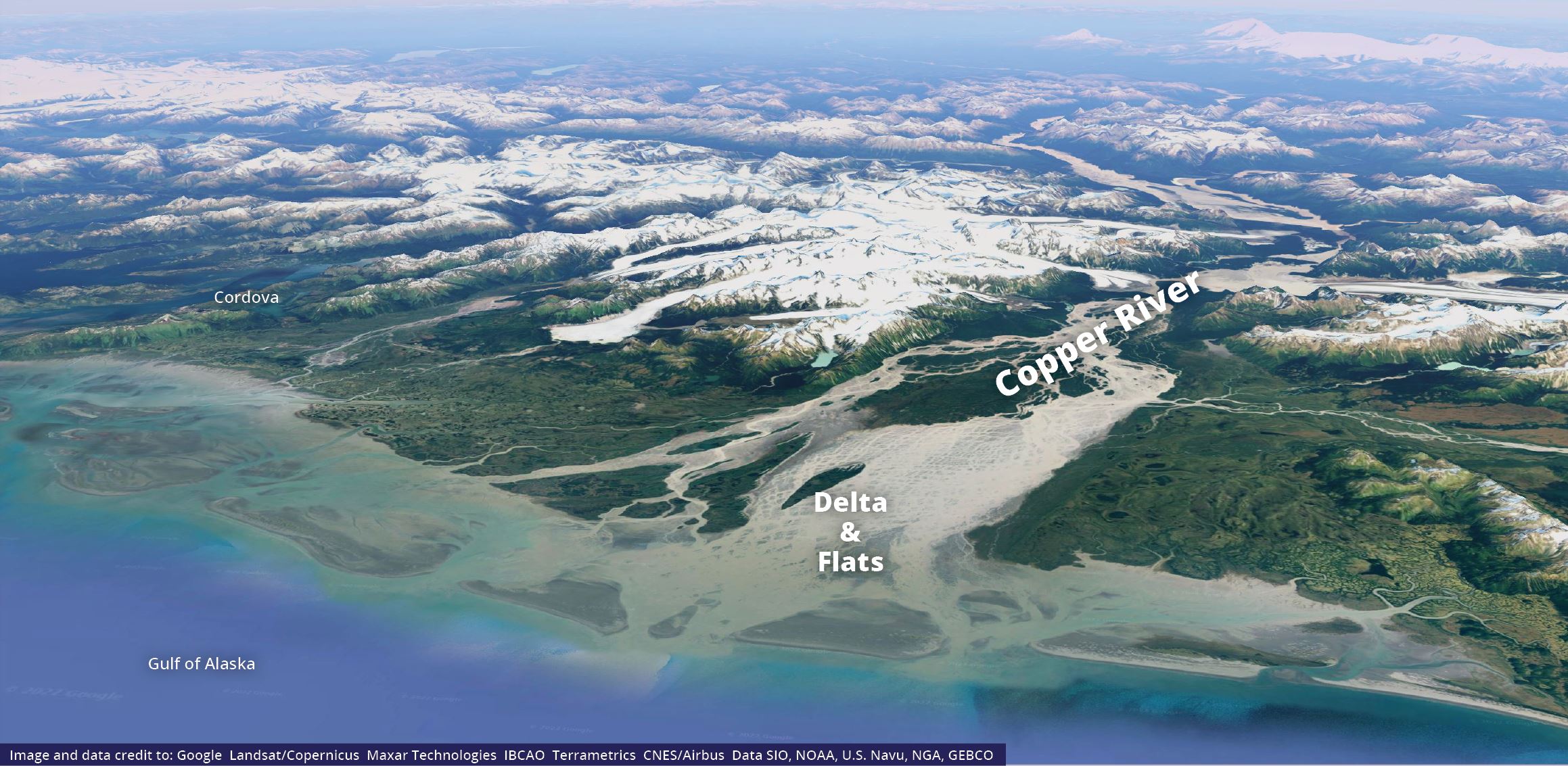
The Copper River region is known for its productive fisheries, wildlife and habitat, and cultural heritage. An estimated 12 million shorebirds migrate through in spring and fall. Salmon from the Copper River, arguably the most famous of Alaska fish, are a vital part of the state’s economy. Alaska Native peoples have called this area home for more than 10,000 years.
Many factors would make cleaning up an oil spill in this area difficult. It is only accessible by air or sea. Shorelines and river channels are frequently changing due to the river currents, tides, and ocean storms. High winds, surf, and varying geography could hamper cleanup efforts.
Collaboration results in detailed plan
In 1995, the spill contingency plan for oil tankers traveling through Prince William Sound went out for public comment for the first time since the Exxon Valdez oil spill. With memories of the 1989 spill still fresh, local Cordovans questioned if a spill in Prince William Sound could migrate into the delta and flats region and how best to prepare for this possibility.
As a result of that debate, a work group formed to develop strategies to protect the area. The group included the U.S. Coast Guard, the Alaska Department of Environmental Conservation, the City of Cordova, and representatives from Cordova District Fishermen United. These local fishermen added knowledge of tides, currents, and other factors that could affect a spill response.
The group developed potential tactics for each zone and other logistical information.
This plan was adopted as part of the State of Alaska’s oil spill contingency plans in 1999.
Changing formats
After 1999, a standard format called Geographic Response Strategies, or GRS, was developed for sites around Alaska that needed special protection. Approximately 700 GRS exist across the state. The format uses consistent symbols and information in each GRS.
The Copper River Delta and Flats plan was developed before these protocols existed and its format is different for that reason.
In 2018, the regulator’s plans changed, and the Copper River and Delta Flats protection information was not carried forward. While the document can still be found today, information in the plan is out of date and work is needed to update and modernize the format.
The State of Alaska and U.S. Coast Guard is currently in the process of updating how the statewide GRS are managed.
“The Council sees this as an opportune time to once again discuss and capture protection strategies for the Copper River Delta and Flats region,” says Jeremy Robida, project manager for the Council.
Researchers recommend updates for the Copper River Delta and Flats plan
The Council started this work to better understand the historical context of the development of the Copper River Delta and Flats plan. The Council worked with Sierra Fletcher and Tim Robertson of Nuka Research and attorney Breck Tostevin to construct a general history of the plan.
The researchers documented the early debate which led to the work group and the current status of the plan. They also made recommendations to help incorporate details from the original plan into a modern GRS format.
“Working through this project really reinforced just how unique this area is, and how it deserves discussion and pre-planning for oil spill prevention and response,” Robida added.
The Council hopes this work will support future planning.
Read more in the report:
Geographic Response Planning for the Copper River Delta and Flats