No plans for repair in near future
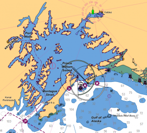
The U.S. Coast Guard’s Vessel Traffic Service, or VTS, which monitors the location of vessels in Prince William Sound, has been operating without radar in recent months.

The Coast Guard monitors traffic in busy ports around the country through these VTS offices. The VTS in Prince William Sound usually operates with a combination of Automatic Identification System, or AIS; VHF radio; cameras; and radar.
AIS is a map-based online monitoring system required to be on board larger vessels. Equipment streams the vessel’s position, along with its name, course, speed, heading, and destination to the system. VHF radio is used for two-way communications with vessels.
These various systems are integrated together and the information is relayed to the Coast Guard’s Marine Safety Unit VTS in Valdez.
Radar is an integral part of the Coast Guard’s monitoring of vessels in Prince William Sound as many small vessels and hazards only appear on radar.
Based on a National Transportation Safety Board report on the Exxon Valdez oil spill disaster, lack of radar is considered a contributing factor to the spill.
U.S. Coast Guard Commander Patrick Drayer joined a Council meeting earlier this fall. In answer to questions from Council members, Commander Drayer noted that all three radar systems in Prince William Sound are obsolete.
Drayer explained that the original manufacturers are no longer in business and that original design drawings are not available. Attempts to fabricate new parts to repair the existing equipment have failed, as the parts did not fit or were not compatible. He also noted that this problem is affecting systems around the country.
Not all vessels use AIS
Many of the vessels in Prince William Sound do not have, and are not required to have, expensive AIS transmitters on board. Only vessels larger than 20 meters (approximately 65 feet) and some passenger vessels* must broadcast their location. Smaller vessels such as commercial fishing vessels, recreational boats, or kayaks may not carry AIS equipment. AIS can also miss smaller objects floating in the water, such as icebergs.
In an October 2020 letter to Senators Lisa Murkowski and Dan Sullivan, and Congressman Don Young, the Council asked for help to secure funds to replace the equipment.
“Based on discussions with the Coast Guard, all of these radar systems have been inoperable for at least ten months,” the letter stated. “Based on limited funding and resources it will take considerable time to repair and eventually replace this aging and inoperable equipment. In addition to the Council’s maritime safety concerns over the lack of Coast Guard radar capability in Prince William Sound, there are also homeland/national security implications of such radar inoperability.”
“The Council is concerned that adequate resources are not yet committed to these priorities,” the letter continued.
All three members of Alaska’s Congressional Delegation responded to the Council’s letter by writing to the Commandant of the Coast Guard requesting information regarding how this problem can be addressed. The Council plans to continue to monitor and advise on this important issue.
* Correction from print edition of The Observer: The original version of this article mistakenly left out that some passenger vessels smaller than 65 feet are also required to broadcast their location, depending on the capacity of the vessel.

