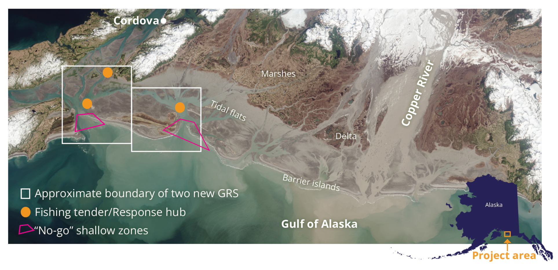
The mouth of the Copper River is a unique geographic area. This 700,000-acre estuary made up of an intricate web of tidal flats, marshes, freshwater ponds, braided river channels, and barrier islands.
By volume, it is the 10th largest river in the U.S. When this volume of fresh water flows into salty seawater, the tides are complex and can be unsafe for vessels to navigate.
Due to the rich sediments brought by the river, wildlife is abundant. Among the habitat’s many residents is the world-famous Copper River salmon, a delicacy that supports a major fishing industry in the nearby town of Cordova, and millions of migrating shorebirds that pass through every year, many remaining to breed in the rich wetlands.
This map shows the location and major features of two of the new GRS.
A group of Alaskans recently collaborated to develop new plans to protect the Copper River Delta and Flats region from an oil spill.
These plans, called geographic response strategies, or GRS, are map-based plans tailored to specific areas that are particularly sensitive to oil pollution. By pre-identifying these areas and planning protection strategies before a spill happens, GRS help save time during the first critical hours of a response.
The rich and diverse habitat at the mouth of the Copper River presents significant challenges to oil spill responders. Rudimentary GRS plans were developed for the area in the late 1990s, however these are dated and no longer readily available. Oil spill response technology has also come a long way. Improvements in vessel capabilities and navigation tools have made a response more feasible.
Collaboration to develop new GRS
The Council worked with experts at Nuka Research to lead a workgroup and help collect the information needed to develop a new set of GRS for the area.
Representatives from the Alaska Department of Environmental Conservation, the U.S. Coast Guard, resource trustees, Cordova nonprofit organizations, and local Cordova fishermen were either involved in the group or consulted during community workshops.
The collaboration resulted in nine new GRS and a tactics guide specific to this unique area. The new plans built off previous efforts where applicable, incorporating new information and ideas.
One innovation is the use of existing fishing tender anchorages as response hubs. Tenders are vessels that anchor near fishing areas to accept fish on behalf of a fish processor, allowing commercial fishing vessels to quickly return to work.
“Response in the area would be challenging, but not impossible. It was really rewarding to build from old plans, have conversations with a wide group of stakeholders, and advance planning and preparedness in the area,” says Jeremy Robida, project manager for the Council.
Due to the Council’s focus on spills from oil transportation through Prince William Sound, the workgroup focused on a hypothetical spill from a tanker in the Gulf of Alaska, with oil migrating into the area.
The finished products, developed through the workgroup, have been provided to the Alaska Department of Environmental Conservation and will go before the Prince William Sound Area Committee to be considered for formal approval in the near future.
Read the report: Copper River Delta and Flats Geographic Response Strategy Development